
Tags
1800s, Anshi Chesed, DeLancy Farm, east side, grid, history, James DeLancey, lower east side, manhattan, maps, new york city, Ohab Zedek
Part of the grassland covering the island of Manhattan during the Lenape era, our land on today’s Norfolk Street lay a short but safe distance from the salt meadows of the East Side. The street, in its earliest incarnation, was a small dirt road cutting into the bucolic land of Pieter Stuyvesant, Director General of the Dutch West India Company, just off Mr. Jones’ property.
Like neighboring Essex and Suffolk Street, it was named after English counties in the early days of English settlement.
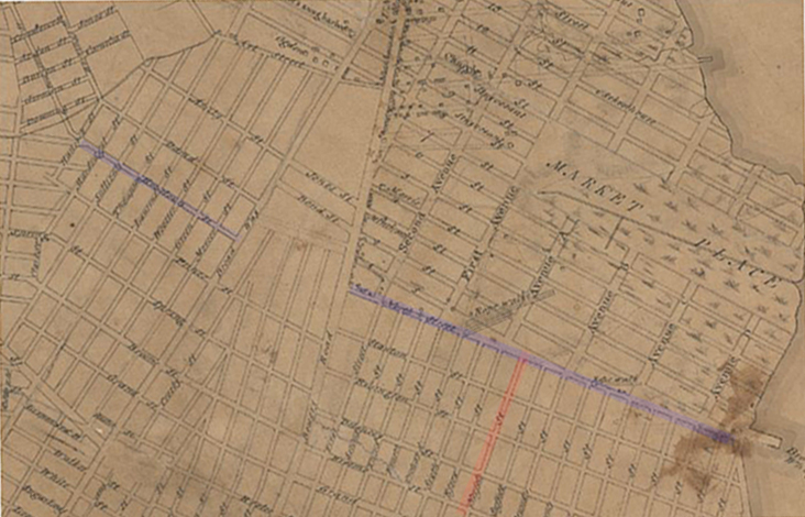
We made a bold attempt to locate Norfolk Street and mark the present location of our building on early maps.
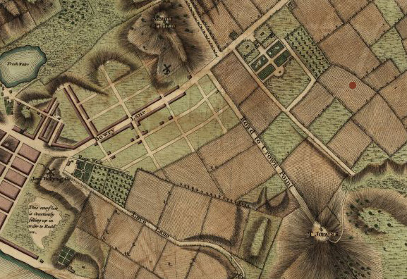
1762 map
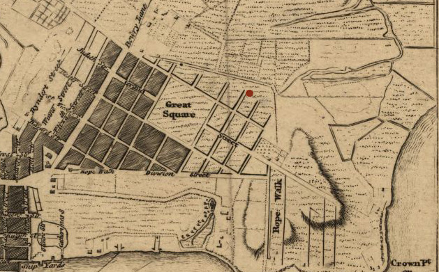
1776 map
In the 1770s, it neatly fit into the island’s first planned street layout, the DeLancey Farm’s grid forming one of the main roads with access to the North from waterways.
James DeLancey developed ‘East-West’ accessibility with new thoroughfares below the spacious core of his estate, the DeLancey Square, modeled after London’s great Georgian residential enclaves.
The street that today runs just South of our building was named after his estate foreman George Stanton, a diligent worker, even after General Washington’s American War of Independence forced the Loyalist DeLancey to desert his entire (legal and natural) family and abandon all his property in the colonies.
In January 1782 Stanton sends a letter to DeLancey’s refuge in London.“I have made it my Business to acquaint your tenants…they answer me in general. Let’s know how the war will end,” writes Stanton to his exiled master. A year later representation of DeLancey’s affairs falls to his friend, Mr. James Rivington (publisher of a pro-British paper during the Revolution and according to some accounts a secret spy for George Washington) who shares the difficulties of his predecessor. Rivington writes, “this must prove most inconvenient and highly mortifying to you” but hints at some [unrealized] hope in 1783: “I flatter myself you will still be able to recover the whole by either by an exception from a prosecution act, or the fair construction of the Treaty.”
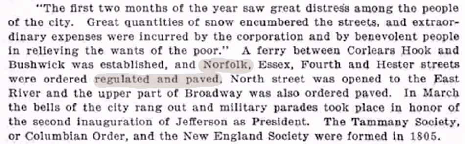
As part of major events in the year of 1805 Cradle Days of New York (1609-1825) lists the paving of Norfolk Street.
Maps show Norfolk Street connecting Division Street–the oirginal dividing line between the Rutgers Farm and the DeLancey Farm in the colonial era–with North Street, a strategic thoroughfare that constituted the geographic border of municipal development on New York’s East Side up until the early 19th century.
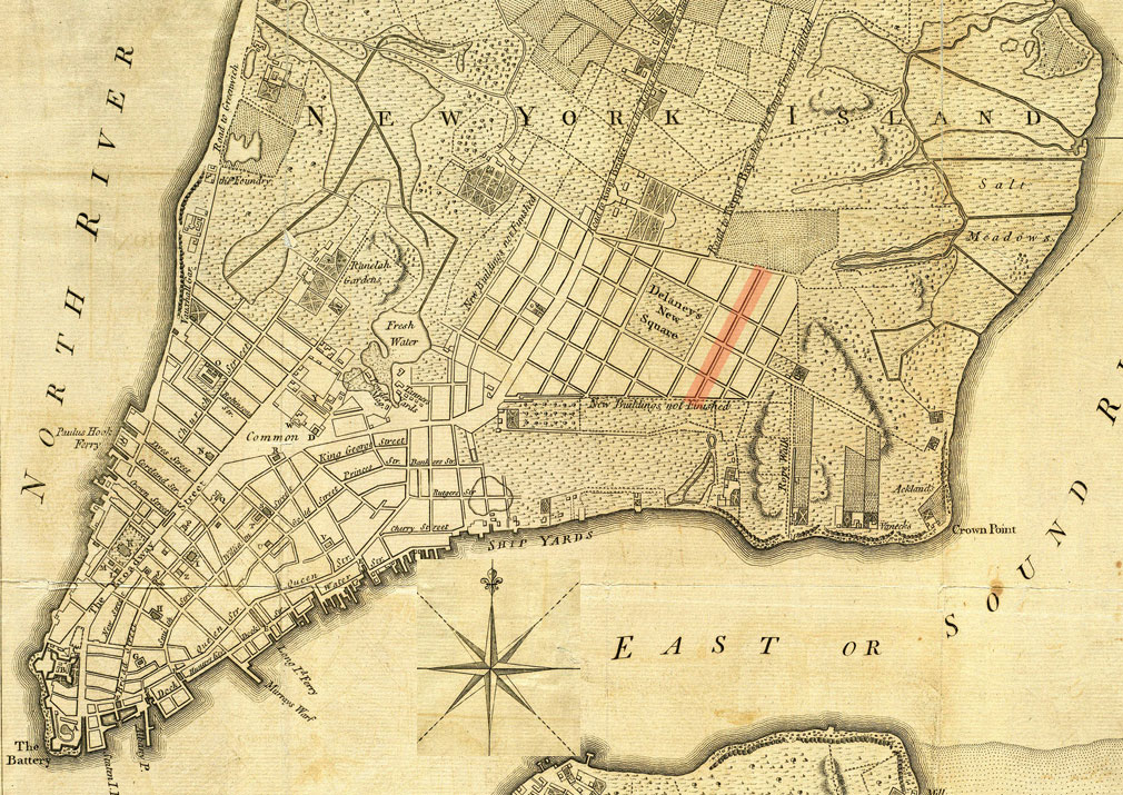
Starting with City Council documents from 1808, North Street becomes Houston Street; the name’s origin and pronunciation is a hot topic to this day. It involved the donation of a cut-through tract of land on the West side of the island (between Bowery Lane and Broadway) that enabled the city to connect a street named Houston to the prominent North street (see map below.) It is reasonable to believe that the street’s nomenclature originates as a grand gesture from the wealthy landowner Nicholas Bayard III, towards his daughter, Mary. She had married a certain William Houstoun [no typo], a delegate to the Continental Congress from 1784 through 1786 and to the United States Constitutional Convention in 1787.
The 1811 Commissioners’ Plan established the foundations of the city grid as we know it, anchored it around the little pedestrian island we now call Peretz Square, just off today’s First Avenue and First Street. The names of the streets below Houston street and East of Essex street, an already established grid, got incorporated with no change into the master plan of the growing city.
1847 map

When a piece of land was purchased by congregation Anshi Chesed in 1849 to build a new synagogue on Norfolk Street, the empty lot was assigned 142-146; the numbering ended with 162 at Houston Street.

In 1886 Ohab Zedek First Hungarian Orthodox Congregation purchased the building and dedicated it on August 13. During the following year they received numerous renovation permits for their new home at 142-46 Norfolk Street. When their rabbi Philip Klein finally arrived in 1890, they celebrated his installation in the same building but at 172-176 Norfolk Street (the address of our building today.)
Posted by Archivist | Filed under around the block

You must be logged in to post a comment.